
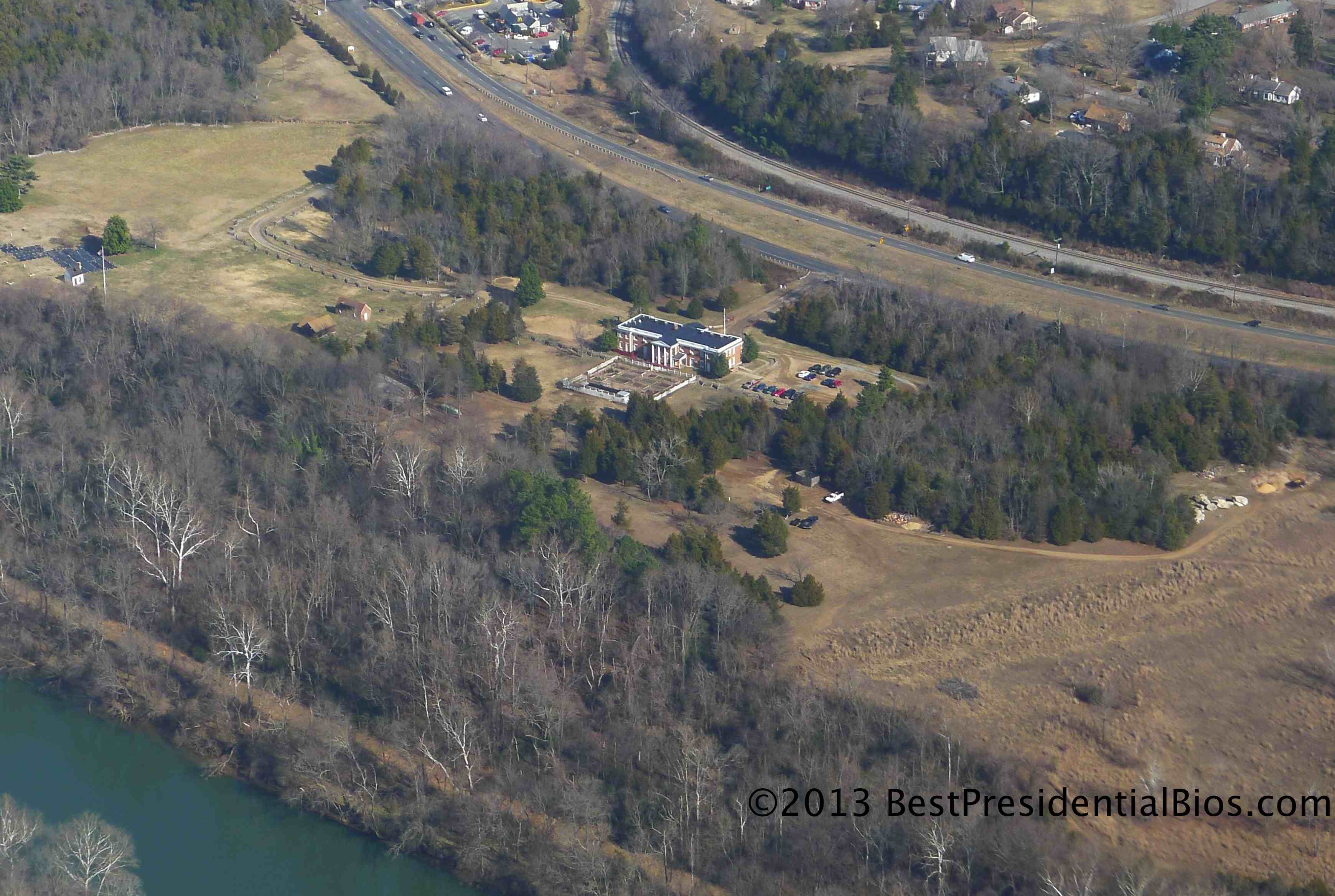
Ferry Farm from ~1,700 feet MSL in a Cirrus SR20
One of the benefits of being a pilot is the ability to see the world from a perspective unavailable to most people. These days, of course, many of us can view our neighborhoods from satellites orbiting high above our planet, use Google Maps to observe the “Street View” of American’s busier roads and highways, and even enjoy the passing landscape as we jet commercially across the country.
Unfortunately for George Washington (and, his demanding and perpetually unsatisfied mother, Mary Ball Washington) none of these vantage points were available in the 18th century.
Here, then, is an aerial view of George Washington’s childhood home, Ferry Farm, which I recently photographed. This picture was taken while flying to the northeast, with the Rappahannock River near the lower left-hand corner. The city of Fredericksburg is just off the left side of the photo, across the river from Ferry Farm.
One can only imagine what George would think if he could take in this view today (much less imagine his traveling by some means other than horseback). He might, however, express at least mild disdain about the McDonald’s which appears, nearly imperceptibly, at the top of the photograph just off the highway.

This is a nice addition to your book reviews. Keep up these “extras.”
I can’t see the cherry tree stump….